Length: Varies
Elevation Change: Varies
Season: Year Round
Difficulty: Moderate due to initial steep climb
Permit: Not Required
GPS: N45 32.331, W122 13.089
Latitude: 45.5388500
Longitude: -122.2181500
Features:
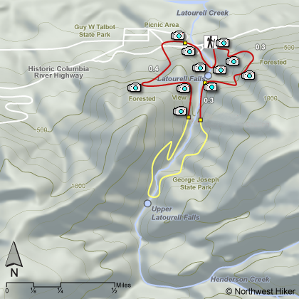
 This hike used to form a short loop of the Latourell Falls area.
But the route became too dangerous, so now it doesn't loop.
This hike used to form a short loop of the Latourell Falls area.
But the route became too dangerous, so now it doesn't loop.
One can follow the trail either clockwise or counterclockwise.
However you choose to hike this trail, use extreme caution as there
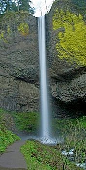
are very steep cliffs and drop-offs along the area near the falls.
The trail used to meander through forested areas to a challenging
creek crossing on an old fallen log before returning to the parking area.
However, this is no longer permitted. It is simply too dangerous.
The hike takes you through a picnic area north of the Old Columbia
River Highway.
|
|
How to get there:
Traveling east on I-84, take Exit #28/Bridal Veil.
Turn right on the Historic Columbia River Highway and travel west for approximately
3 miles to the parking lot on the left/south side of the road. There are bathroom facilities
at this location.
Traveling west on I-84, take Exit #35/Ainsworth. Drive 11 miles west on the
Historic Columbia River Highway to the parking lot on the left/south side of the road.
|