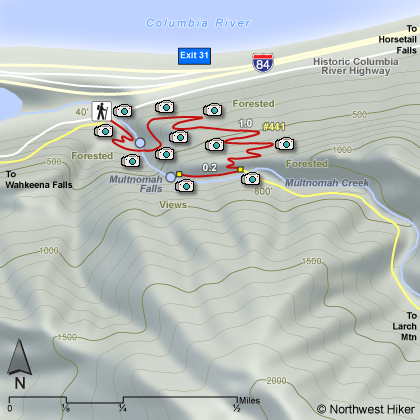
Length: 1.2 miles one way
Elevation Change: 760'
Season: Year Round
Difficulty: Moderate due to steepness of trail
Permit: Not Required
Features:
This paved trail takes the hiker across the bridge between the
lower and upper falls, then continues steeply through mostly wooded
areas with occasional views and many switchbacks to the top of the
ridge. Then the trail descends to an overlook at the very top
of the upper falls.
This trail is normally accessible all year long, but in the winter
be aware of the icy, slick conditions and take appropriate measures.
On a hot summer day, this is particularly fun to hike and enjoy the
cool spray, but in the winter the same spray can give you a chill.
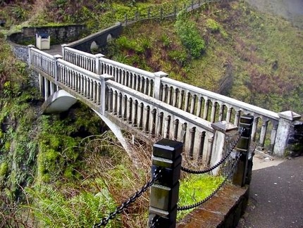 Benson Bridge at the base of Multnomah Falls is temporarily closed.
|
|
How to get there:
From I-84 take Exit #31/Multnomah Falls. Park in the parking lot and walk under
the footbridge to Multnomah Falls Lodge.
Alternatively, take I-84 east to Exit #28/Bridal Veil and drive east on the
Historic Columbia River Highway to the Multnomah Falls Lodge parking area.
Coming from the east on I-84, take exit 35 (Ainsworth Park) and drive about 4 miles west on the
Historic Highway to reach the Multnomah Falls Lodge parking area and trailhead.
From Portland, due to overcrowding at Multnomah Falls in peak season, we highly recommend for convenience and safety, that
you consider using the Gorge Transit bus .
The price is low and the convenience is high.
|