Length: 12.2 Miles round trip
Elevation Change: 2350' Cumulative Elevation gain
Season: Summer thru Fall
Difficulty: Challenging
Permit: Wrist-Band from Observatory
Volcano Alert
Call this number to see if this trail is closed:
360-449-7800
Features:
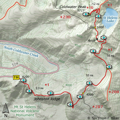
This superb hike begins at the northeast
corner of the Johnston Ridge parking lot.
The first 1/4 mile of the trail is paved
Visitors Center.
The trail follows Johnston Ridge eastward
in such a way that you get outstanding
views of Mt St Helens to the south,
Harry's Ridge to the east, and Coldwater
Peak to the north. The first 2 miles
of this hike are heavily used and have
rest benches from time to time. But
after about 2 miles, the traffic really
thins out.
At 2.3 miles you come to the junction
with Trail #207 that cuts over to
Windy Ridge. Keep straight ahead on
your Trail #1 (known as the Boundary
Trail). This is actually the low
point in the hike. From here on you
climb, gently at first, then quite
steeply later.
A little over 3 miles into the hike
you will cross a substantial metal
bridge just before the junction to
Trail #208 that leads to Harry's Ridge.
Keep straight and after crossing a
saddle area with excellent views of
Spirit Lake and Mt Adams to the east,
the trail climbs quite steeply for
the next mile.
The trail will take you to a ridge
where you can look down on St Helens
Lake and over to Mt Margaret. Mt
Rainier will be peaking over the
ridge to the north of the lake.
The trail follows around this
ridge then descends into an extremely
unique hole in the ridge.
The trail passes right through the
hole, or arch as some refer to it.
On the north side the trail skirts
the ridge and you can look down on
spectacular views of St Helens Lake.
In about a half mile you will come
to a major junction of trails.
At this point, keep on Boundary
Trail #1 which heads north along
the west side of St Helens Lake.
In about another 3/4 mile you will come
to the junction of Trail #1E. Bear
left and begin the steep, well
switch backed climb to the top of
Coldwater Peak. With every step you
gain better views of the surrounding
terrain, including Mt Adams to the
east, Spirit Lake, St Helens Lake,
and of course Mt St Helens itself.
From the top of Coldwater Peak you
get more excellent vistas to the
west and to the north where you can
see Mt Rainier.
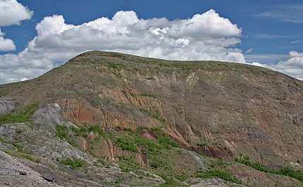
Harry Ridge in the Mt St Helens National Volcanic Area
|
How to get there:
NEW!
Click for PDF Directions Map of this Hike
From Seattle, WA
Drive south on I-5 to the junction of State Road 504. Exit the freeway, and turn
left (east) onto SR504 and follow it east. At five miles you will pass the Silver Lake
Visitor Center and in another 38 miles you will come to the junction to SR504 E.
Bear right onto SR504 East and follow it another 8 miles to the Johnston Ridge Observatory.
(closed in winter)
From Portland, OR
Drive north on I-5 to the junction of Washington State Road 504. Exit the freeway, and turn
right (east) onto SR504 and follow it east. At five miles you will pass the Silver Lake
Visitor Center and in another 38 miles you will come to the junction to SR504 E.
Bear right onto SR504 East and follow it another 8 miles to the Johnston Ridge Observatory.
(closed in winter)
|