Length: 4.6 mi RT
Elevation Change: 1136' gain
Season: Mid-summer thru Fall
Difficulty: Challenging
Permit: NW Forest Pass Not Required
Features:
NEW!
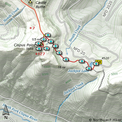
Click for PDF Topo Map of this Hike
This hike begins on Forest Road #20. The trailhead
is the approach to Jackpot Lake as well as Cispus Point.
As you begin this hike, you will be walking through
a dense forested area with small ponds along the way.
Keep in mind that this trail is ancient and historic.
For hundreds of years, the native people used this
trail to travel and carry on commerce between the
tribes west of the Cascade Mountains and those on the east side.
The trail has little use past Jackpot Lake and can be
difficult to follow at times. However, within a half
mile or so, the trail begins to climb.
Within another mile and a half you will junction with
the trail that takes you to the top of Cispus Point.
Bear left onto this trail and after another half mile
of very steep climbing, you reach the summit and get
to enjoy world class spectacular views of the surrounding
volcanos.... Rainier, Adams, and St. Helens.
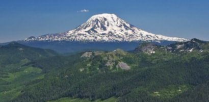
Mt. Adams from Cispus Point
|