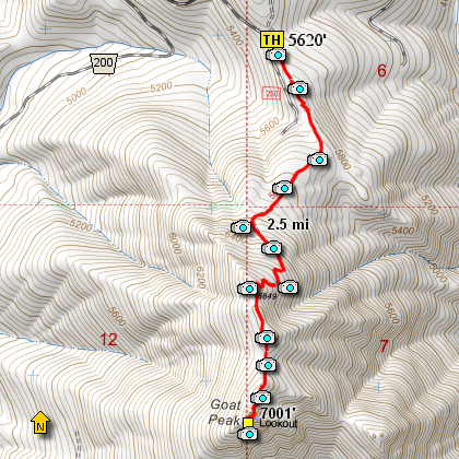
Length: 5 mile RT
Elevation Change: 1400' cumulative elevation gain
Season: Summer thru Fall
Difficulty: Challenging
Permit: NWF Pass Required
Features:
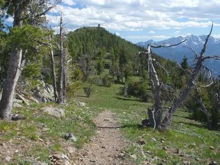
The Goat Peak Lookout trail alternates between forest and open meadow
as it ascends the north ridge of the peak. The last half-mile to the
lookout is along an open ridge with good views of the rugged North
Cascades peaks. There is no water on this trail. This is a steep but
short trail with fine views of the Methow Valley. At one time there
were fire lookout towers on many of the peaks in this area. In recent
years, aerial reconnaissance has gradually replaced these lonely
outposts. Goat Peak is the only lookout in the Methow Valley Ranger
District that is still staffed.
For the past several years, the peak has been manned by a fellow who
calls himself Lightening Bill. He has been known to greet visitors
with a broad smile and little "gifts,” compliments of the USFS.
|