Length: 1.25 miles round trip
Elevation Change: 340' cummulative gain
Season: Nearly Year-round
Difficulty: Easy to Moderate
Permit: Recreation Pass Required
Features:
Even though you can drive nearly to the summit
of Marys Peak, it is so worth it. If you want
to make more of an adventure, you can always
begin the hike lower on the mountain. Click
HERE for more information on this option.
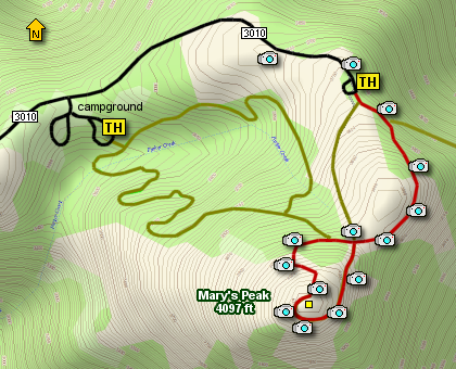
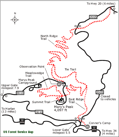
As you can see from the map, there are several
hiking options once you arrive at the parking area.
I did the hike via the red trail.
If you hike on Marys Peak any time between
May and August, you will be treated to incredible
floral displays. The vast meadows along the
way afford an on-going unfolding of new wild
flowers about every two weeks.
And, if you are fortunate enough to be up there
on a perfectly clear day, the views are simply
world class. Not only can you see the Pacific
Ocean to the west, but you can also view several
of the volcanoes in the Cascade Mountains; ranging
from Mt. Rainier in the north to the 3 Sisters to
the southeast.
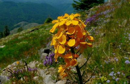
Floral display along the Mary's Peak trail
|