Length: 4.8 miles RT
Elevation Change: 1540'
Season: All Year
Difficulty: Challenging due to steep climb
Permit: No Pass Required
Features:
NEW!
Click for PDF Topo Map of this Hike
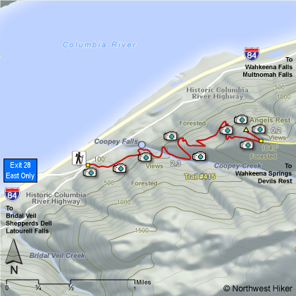
This hike is relatively steep as it
climbs through wooded areas and eventually out in the open near
the summit of Angel's Rest where there are great vistas of the
Columbia River Gorge and the surrounding mountains. You pass
Coopey Falls near the beginning of the hike.
The trail continues climbing, and shortly you cross a fine wooden
bridge over Coopey Creek. After a switchback, the trail follows
Coopey Creek for some distance before doing another sharp turn
to the left where you leave the Coopey Creek valley and begin the
steep climb up Angels Rest.
At first you will only have occassional glimpses of the gorge below,
but as you get higher and higher, the views improve until you finally
reach the top and have a full unobstructed view. Just before you
reach the top, a trail junctions off to the right (east) which is the
trail to Devils Rest and/or Wahkeena Falls and/or Multnomah Falls.
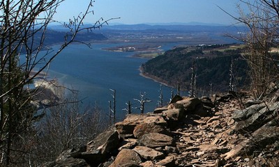 Looking west from the Angels Rest trail near the summit
|
|
How to get there:
From the west, take I-84 east to Exit #28/Bridal Veil. Follow the road to the stop
sign and turn right onto the Historic Columbia River Hwy. The parking lot is
immediately on right. No parking pass required.
From the east, take I-84 west to Exit #35/Ainsworth State Park. Follow the
Historic Columbia River Highway for 7.1 miles to the Angel's Rest Trailhead
and the parking area is on your right. No parking pass required.
|